



Jarvizar City Model Open the app

Press Kit

Jarvizar City Model is a free web app that turns any place on the map into a multicolor 3D printable model. Everything on this page may be used in articles and videos about it, monetized videos included, without asking. Credit: Adam Jarvis.

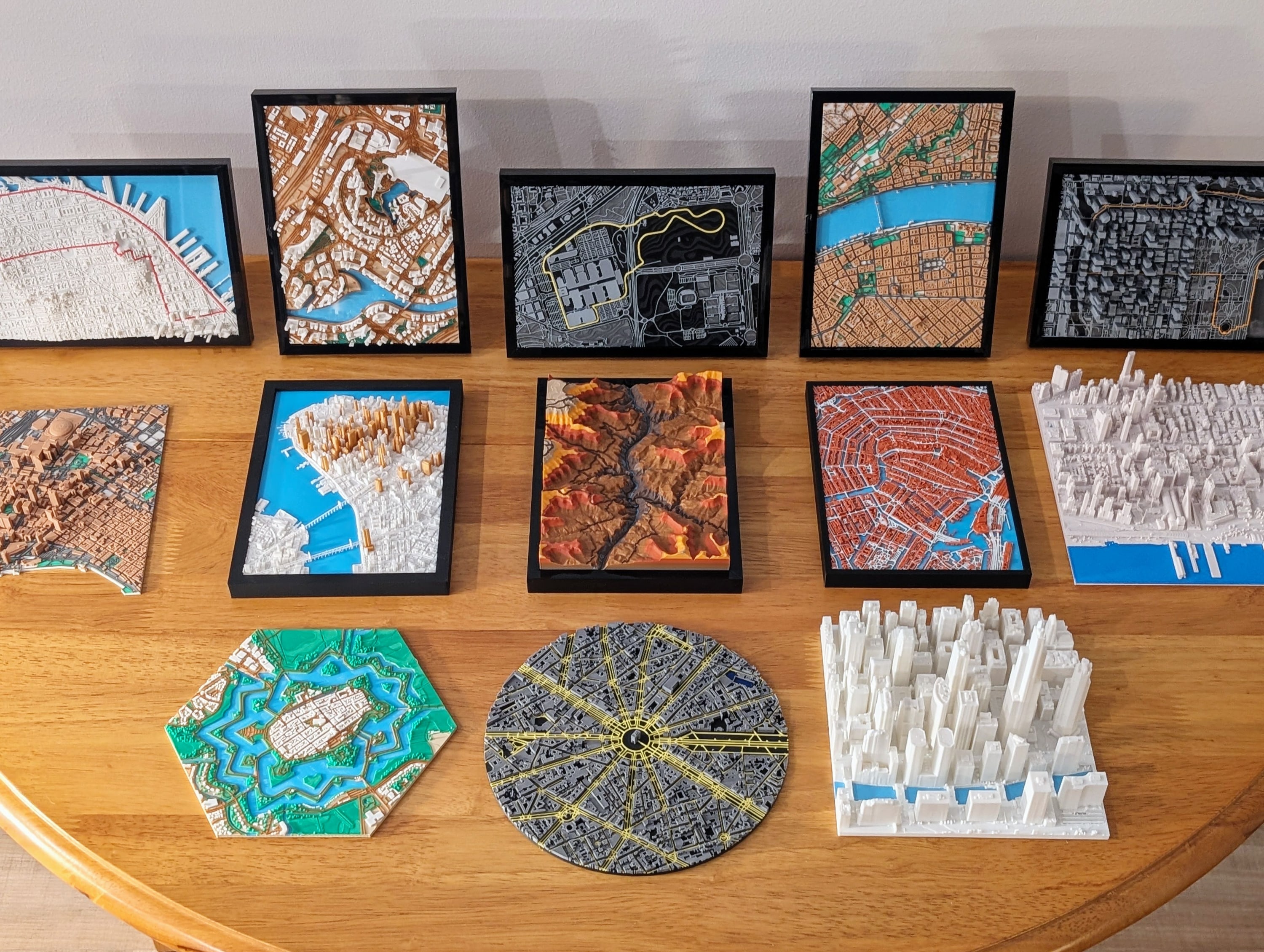
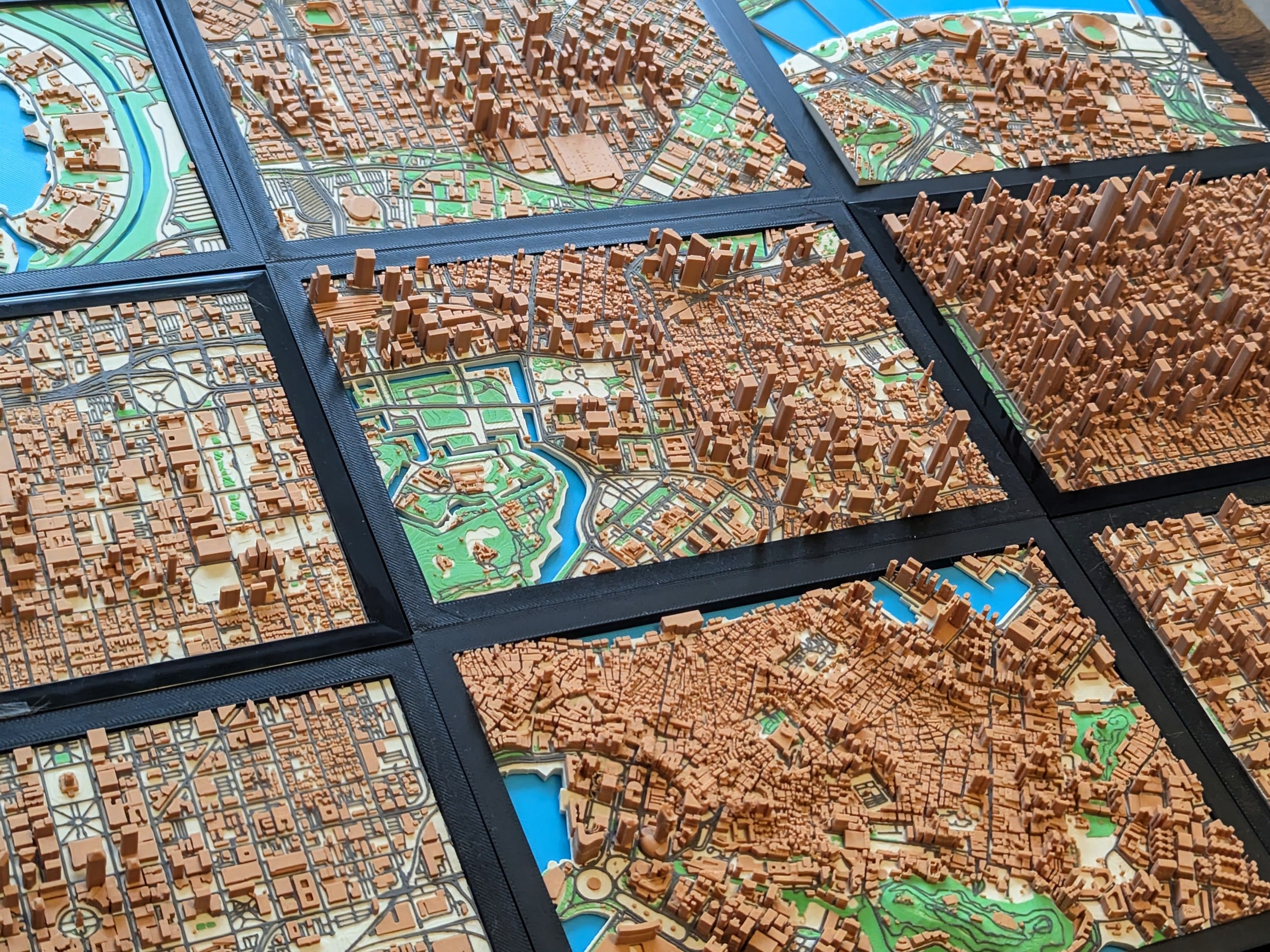
Photo: Prints made with the app. Cities, terrain, shapes, a route, and LiDAR only models, all made with the app.
Real prints. Cities, terrain, shapes, a route, and LiDAR only models, all made with the app. Download photo JPEG, 3000 × 2259, 1.1 MB

Fact Sheet

Name
Jarvizar City Model, or City Model after the first mention
Made by
Adam Jarvis, who posts map miniatures on MakerWorld as Jarvizar
Website
citymodel.jarvisar.com
Price
Free. Paid tiers are one payment for lifetime access: $25, $79, and $199, or $19, $59, and $149 for the first 50 backers of each.
Campaign
MakerWorld, November 10 to December 10, 2026
Runs in
Chrome, Edge, Firefox, and Safari on computers, phones, and tablets. No install or account.
Exports
Bambu Studio and PrusaSlicer projects, 3MF with colors, and STL
Map data
OpenStreetMap, Overture Maps, and Mapterhorn elevation
LiDAR
Public surveys from over 50 sources
Examples
160 ready-made models
Press contact
citymodel@jarvisar.com

Descriptions

One line

21 words

Jarvizar City Model is a free web app that turns any place on the map into a multicolor 3D printable model.

Short

61 words

Jarvizar City Model turns any place on the map into a multicolor 3D printable model with terrain, water, parks, roads, and buildings. Where a public LiDAR survey covers the area, it rebuilds the real roofs, towers, and spires from the scan. The app runs in the browser with no account and exports Bambu Studio and PrusaSlicer projects, 3MF, and STL files.

Long

223 words

Jarvizar City Model is a web app for making 3D printable models of real places: cities, hometowns, mountains, islands, stadiums, and racetracks. People pick an area on the map, set the size and colors, and the app builds the model in the browser from OpenStreetMap and Overture Maps data and public elevation data. Terrain, water, parks, roads, and buildings each print as their own part in their own filament, and the files open in Bambu Studio and PrusaSlicer with the colors already assigned.

Where a public LiDAR survey covers the area, the app downloads the scan straight from its publisher and measures the real shapes of roofs, towers, and spires. LiDAR only models are built from the scan alone, with the buildings, trees, and bridges in it. Coverage includes most of the United States, much of Europe, New Zealand, parts of Canada, and cities such as Tokyo and São Paulo, from over 50 sources.

The app is free, including downloads up to 256 mm across. Paid tiers add custom routes, names and map pins, prints split across several plates, LiDAR outside the free areas, and LiDAR only models. They are sold as lifetime access through a MakerWorld crowdfunding campaign from November 10 to December 10, 2026. Adam Jarvis built the app after making over 150 map miniatures by hand for MakerWorld as Jarvizar.

What It Does

  • Any place on the map, found by search or by dragging a box, cut as a rectangle, rounded rectangle, circle, or hexagon.
  • Terrain, water, parks, roads, and buildings as separate parts, each in its own filament. Bridges and trees are optional.
  • 16 color themes, any filament color for any part, and separate colors for tall buildings, road types, and terrain height bands.
  • LiDAR buildings, with roof shapes measured from public laser scans, and LiDAR only models built from the scan alone.
  • Routes from GPX, FIT, TCX, KML, KMZ, or GeoJSON files, printed along the streets in their own color, and over 125 built-in racetracks.
  • Names and map pins printed on the model.
  • Large models split across as many plates as needed, each sized to the printer's bed.
  • An editor for removing or raising buildings, widening roads, and drawing roads, buildings, and land cover before downloading.
  • Single-color printing works too: streets, water, and buildings sit at different heights, so they still show.
  • Models are built in the browser. Nothing is installed or uploaded.

Photos of printed models, all made with the app and printed on a Bambu Lab P1S or H2D.

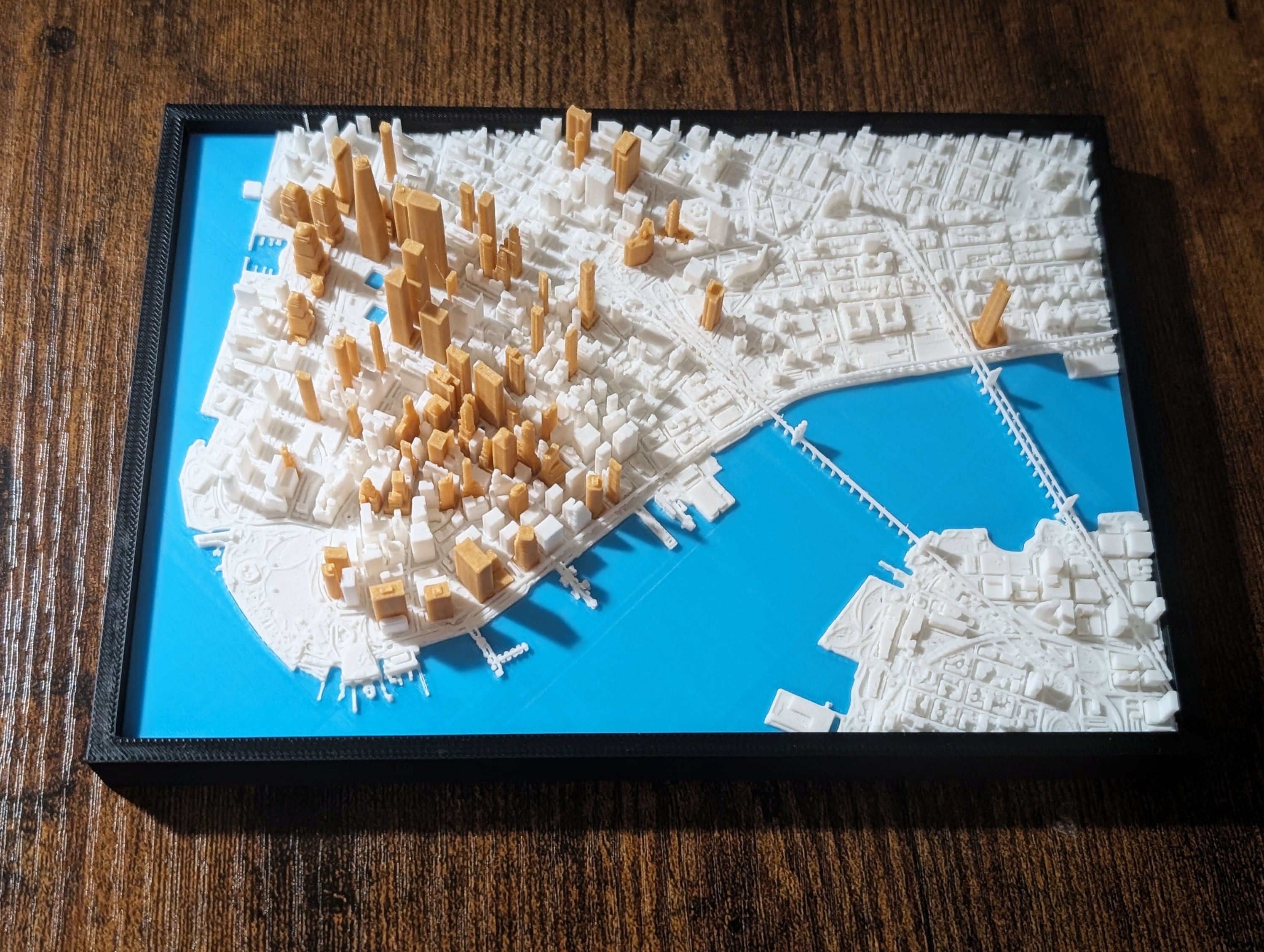
Photo: Lower Manhattan. From map data, in white with the towers over 150 m in their own color.

Lower Manhattan

From map data, in white with the towers over 150 m in their own color.

Download JPEG, 3000 × 2259, 941 KB

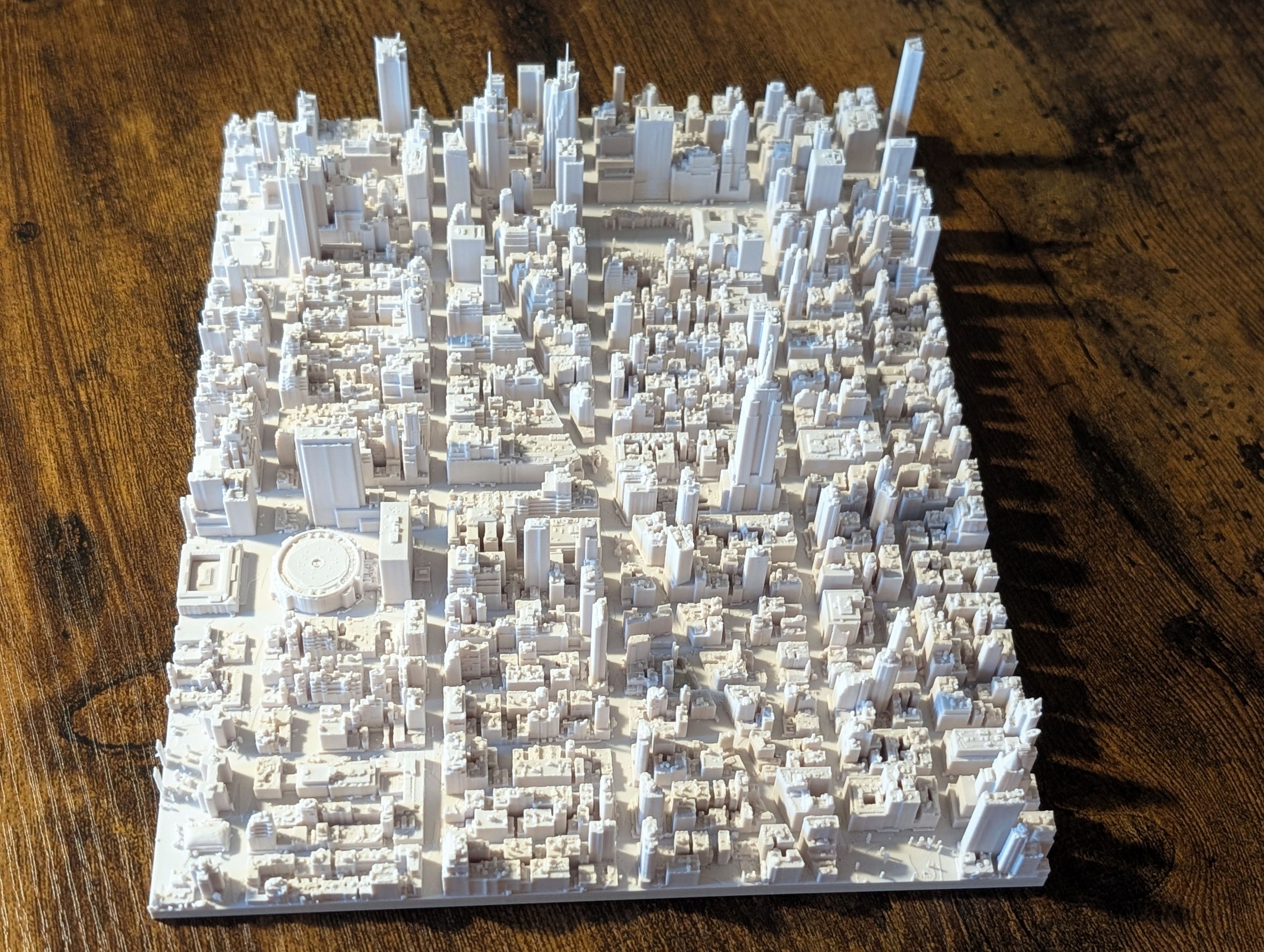
Photo: Midtown Manhattan, LiDAR only. Built from a LiDAR survey alone and printed in white.

Midtown Manhattan, LiDAR only

Built from a LiDAR survey alone and printed in white.

Download JPEG, 3000 × 2259, 1.1 MB

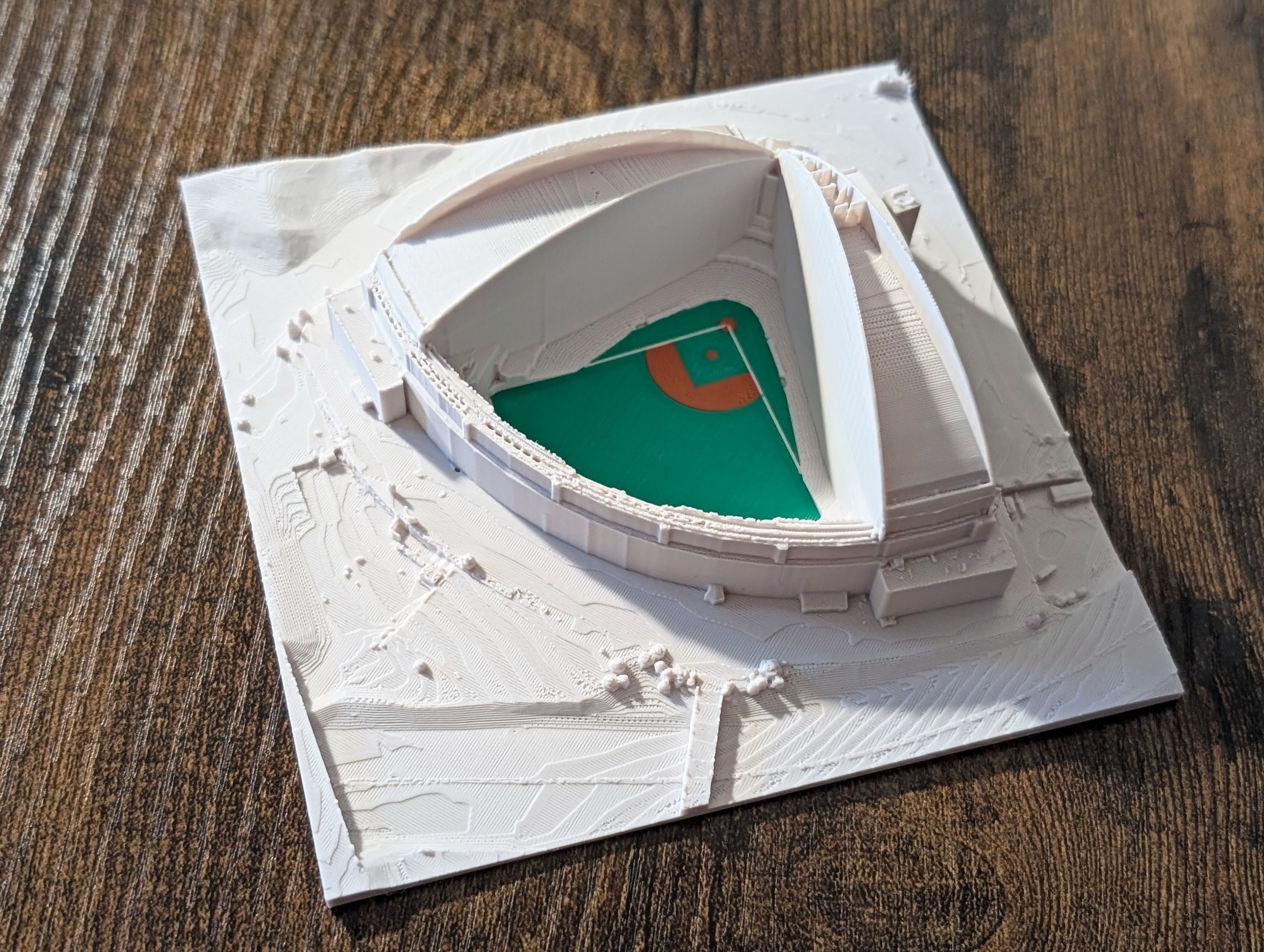
Photo: American Family Field, Milwaukee. LiDAR only, with the field printed in its own colors.

American Family Field, Milwaukee

LiDAR only, with the field printed in its own colors.

Download JPEG, 3000 × 2259, 1012 KB

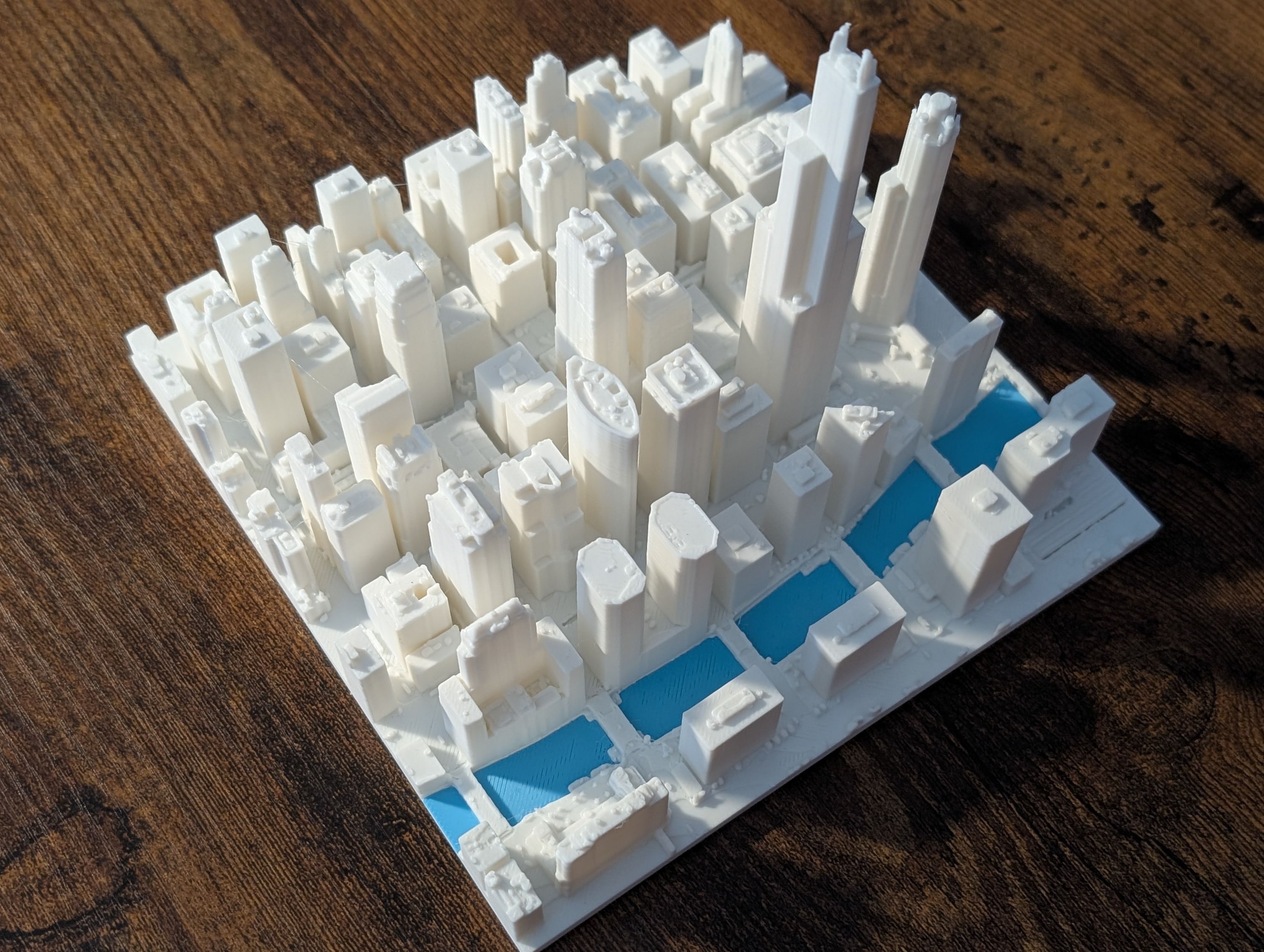
Photo: Chicago, LiDAR only. The Loop around the Willis Tower, in white with the river in blue.

Chicago, LiDAR only

The Loop around the Willis Tower, in white with the river in blue.

Download JPEG, 3000 × 2259, 830 KB

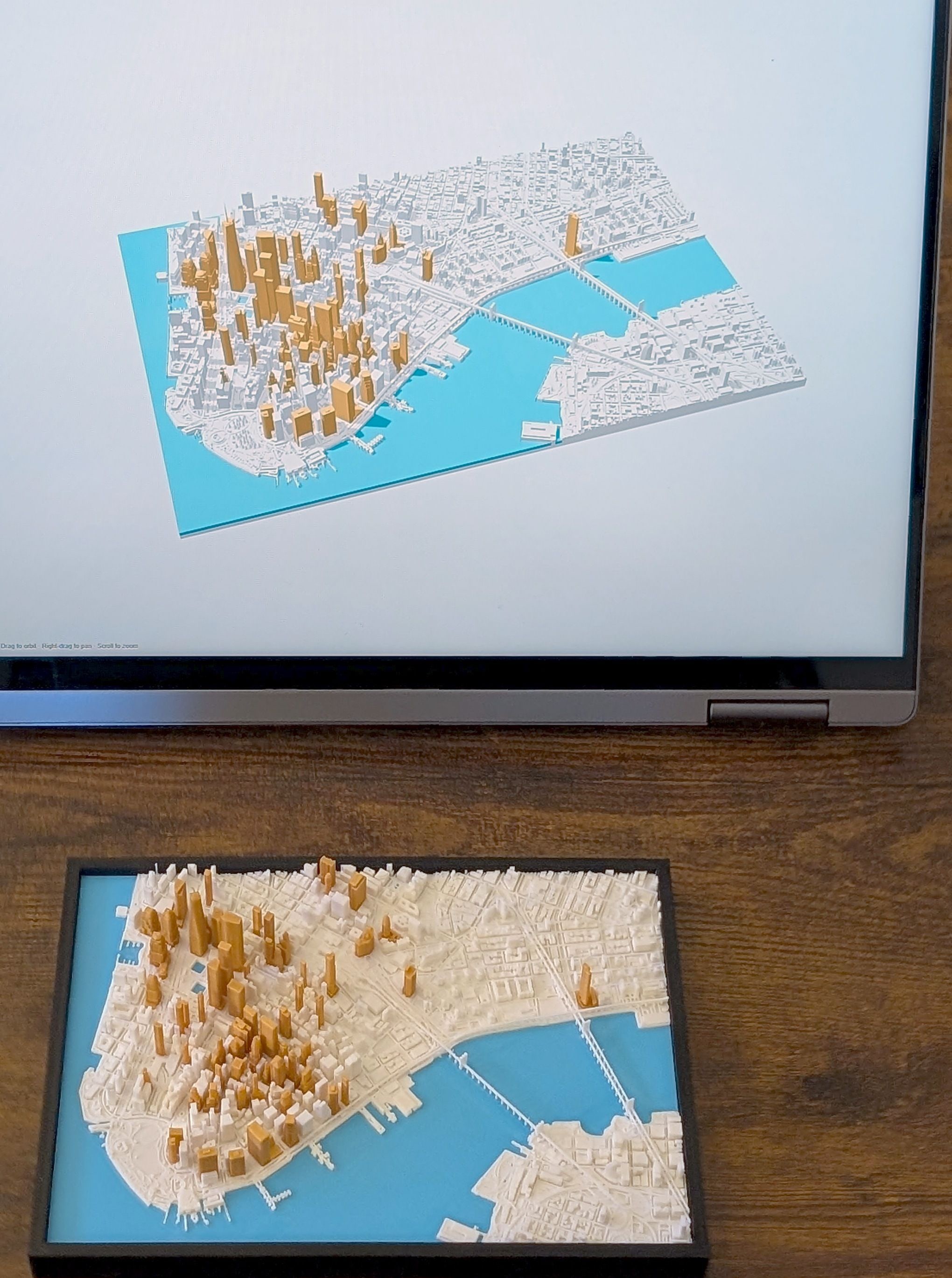
Photo: The app and the print. Lower Manhattan in the app's 3D view, next to the printed model.

The app and the print

Lower Manhattan in the app's 3D view, next to the printed model.

Download JPEG, 2040 × 2739, 562 KB

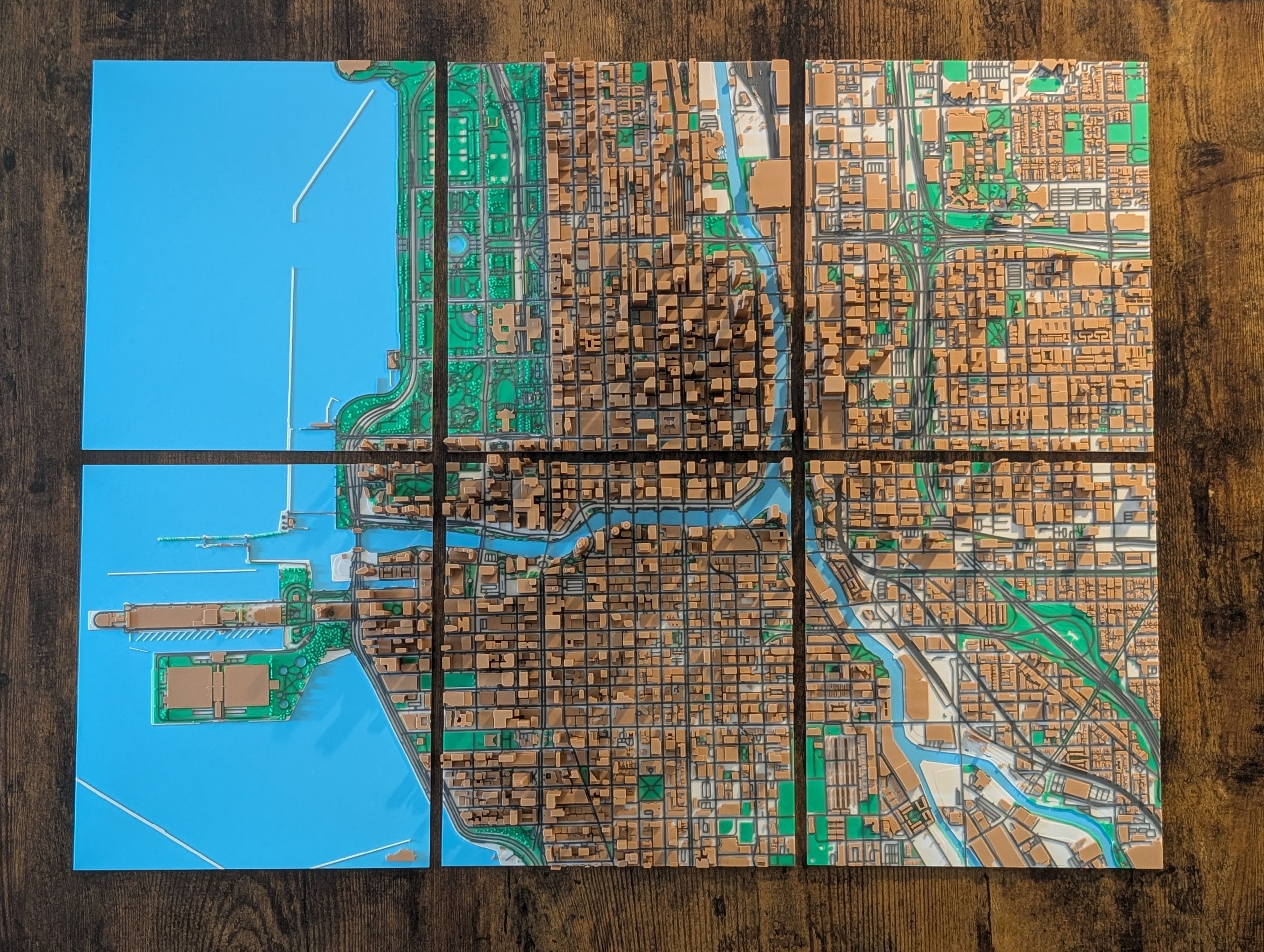
Photo: Chicago on six plates. A larger area split across six plates, each sized to fit the printer.

Chicago on six plates

A larger area split across six plates, each sized to fit the printer.

Download JPEG, 3000 × 2259, 1.2 MB

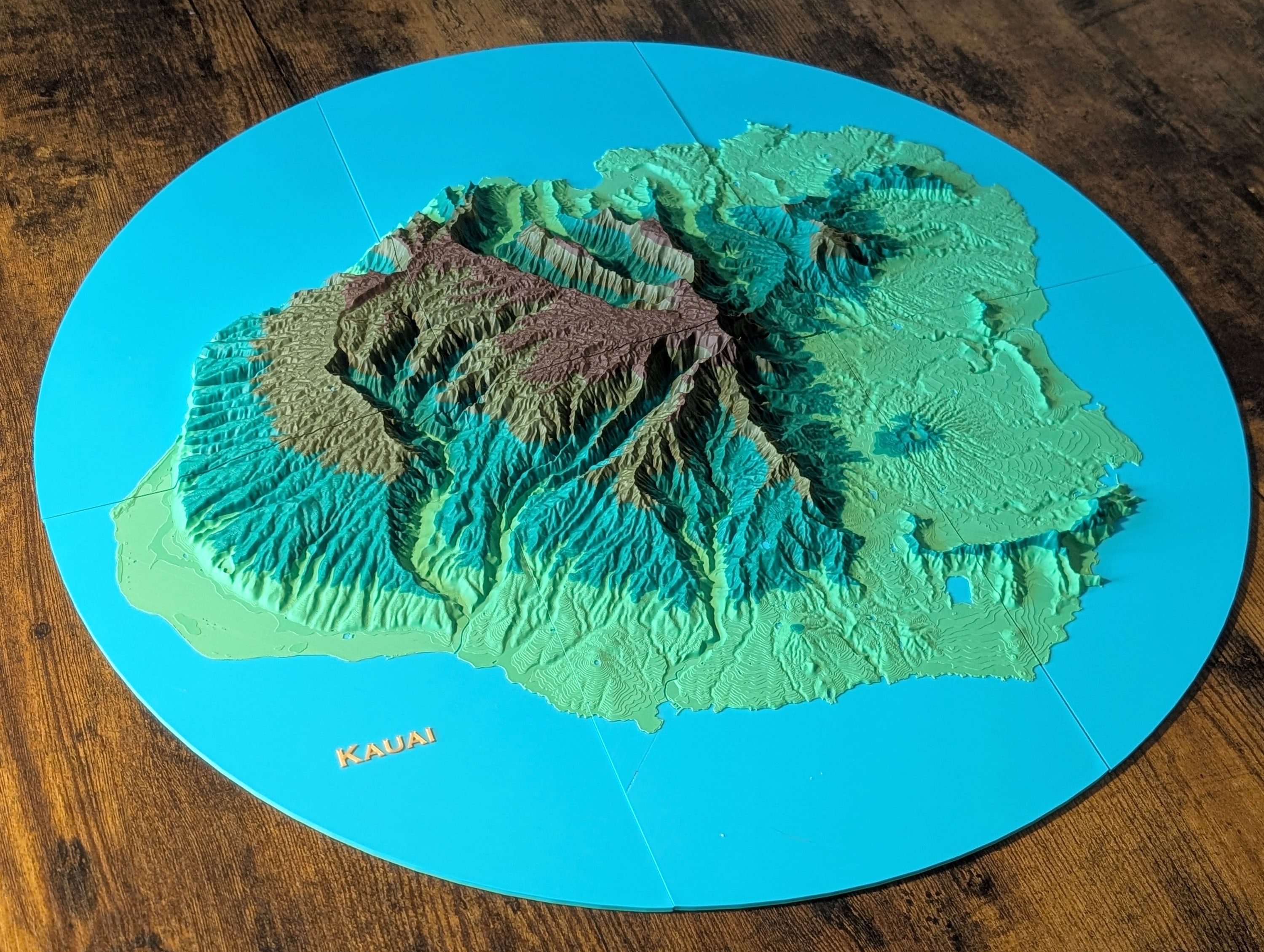
Photo: Kauai. Terrain colored by height, cut as a circle, and printed in parts.

Kauai

Terrain colored by height, cut as a circle, and printed in parts.

Download JPEG, 3000 × 2259, 1.0 MB

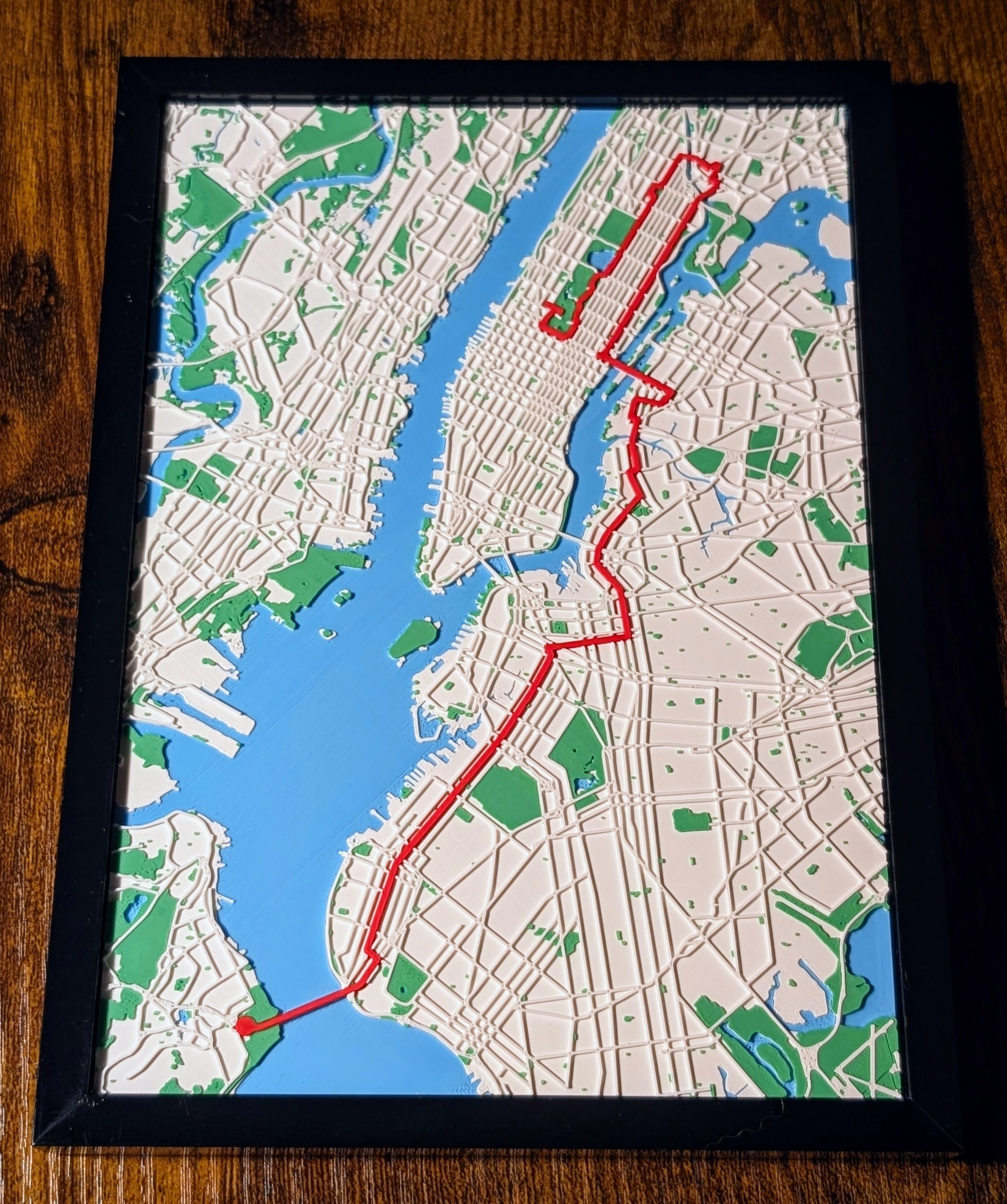
Photo: New York City Marathon. The race route in red across the five boroughs.

New York City Marathon

The race route in red across the five boroughs.

Download JPEG, 2508 × 3000, 1012 KB

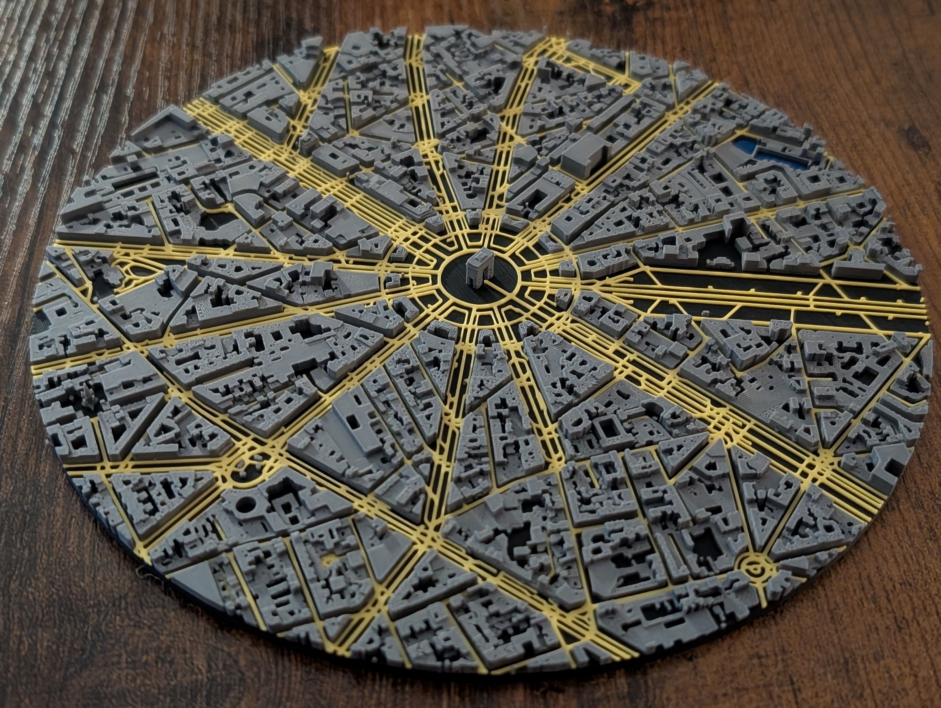
Photo: Arc de Triomphe, Paris. Cut as a circle, with the streets in gold.

Arc de Triomphe, Paris

Cut as a circle, with the streets in gold.

Download JPEG, 3000 × 2259, 966 KB

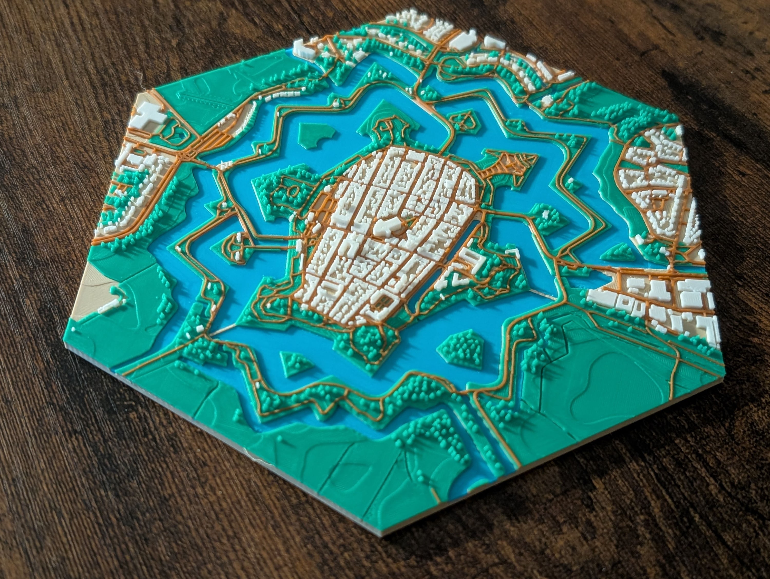
Photo: Naarden, Netherlands. The star fort cut as a hexagon.

Naarden, Netherlands

The star fort cut as a hexagon.

Download JPEG, 3000 × 2259, 996 KB

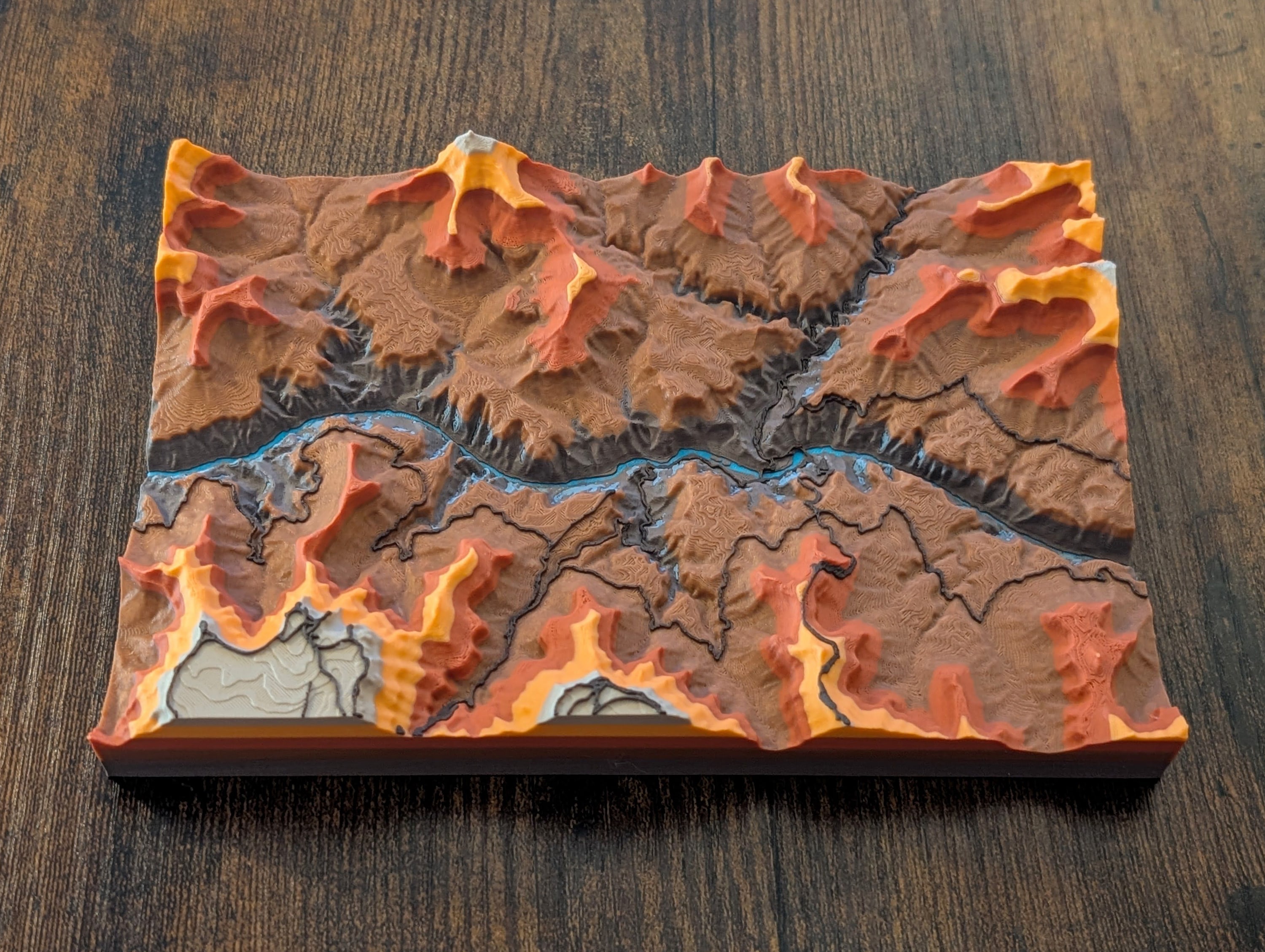
Photo: Grand Canyon. Terrain colored by height.

Grand Canyon

Terrain colored by height.

Download JPEG, 3000 × 2259, 978 KB

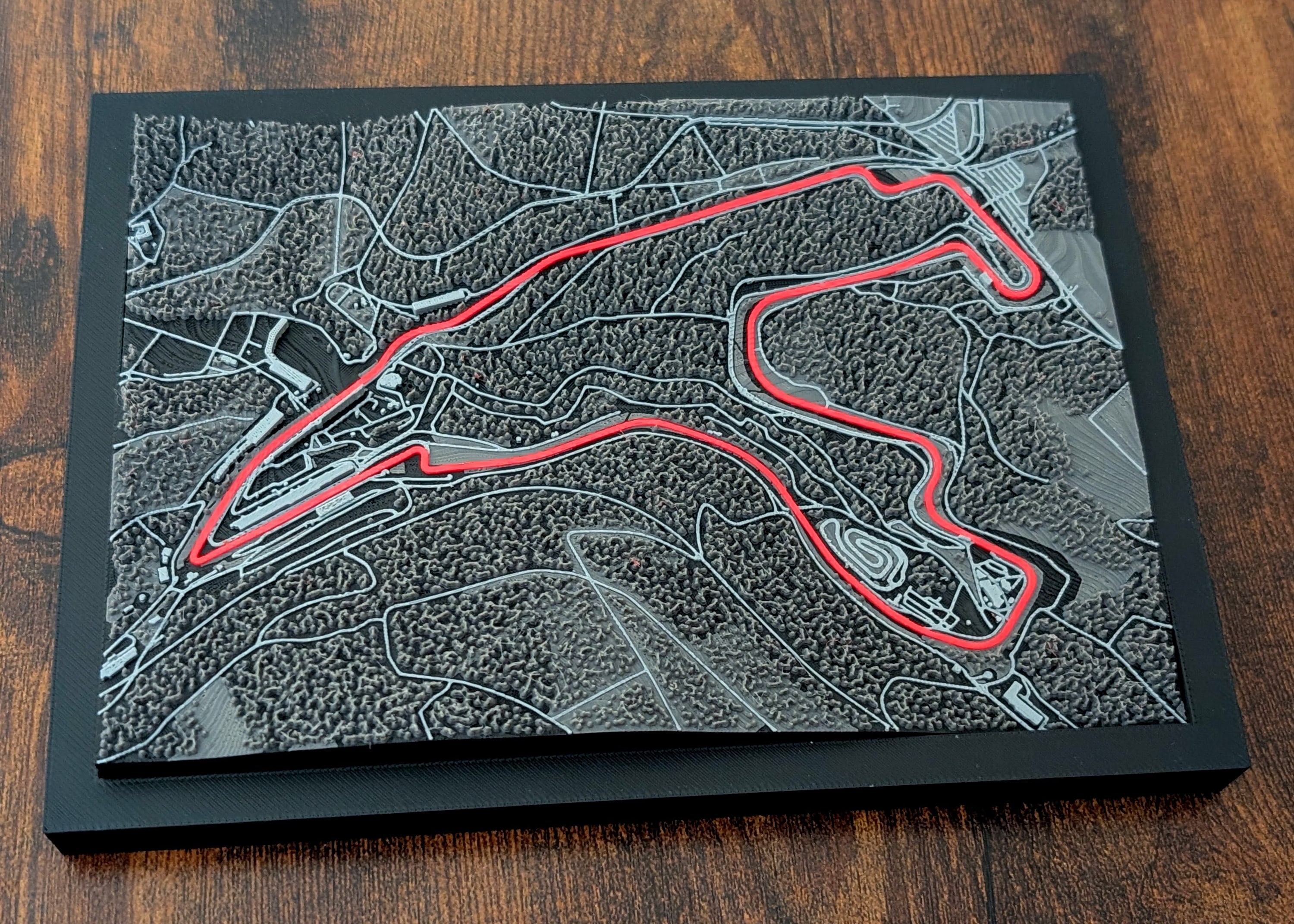
Photo: Spa-Francorchamps. The circuit in red, raised above the roads around it.

Spa-Francorchamps

The circuit in red, raised above the roads around it.

Download JPEG, 3000 × 2144, 1.2 MB

Blender renders of models exported from the app, not photos. Please caption them as 3D previews or renders.

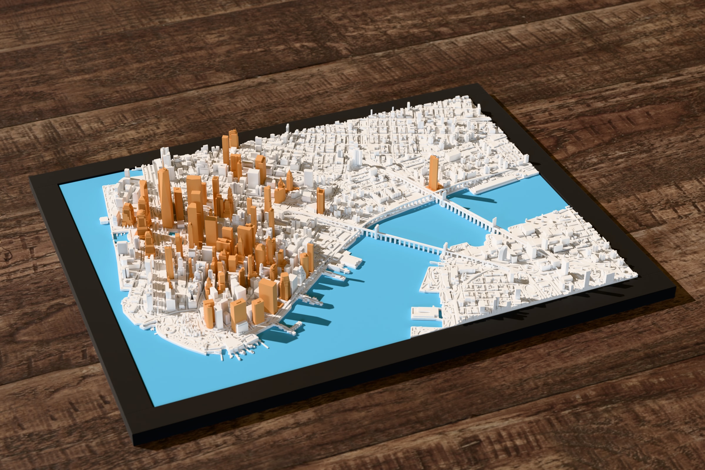
3D preview: Lower Manhattan. In white, with the tallest towers in gold.

Lower Manhattan

In white, with the tallest towers in gold.

Download JPEG, 2400 × 1600, 625 KB

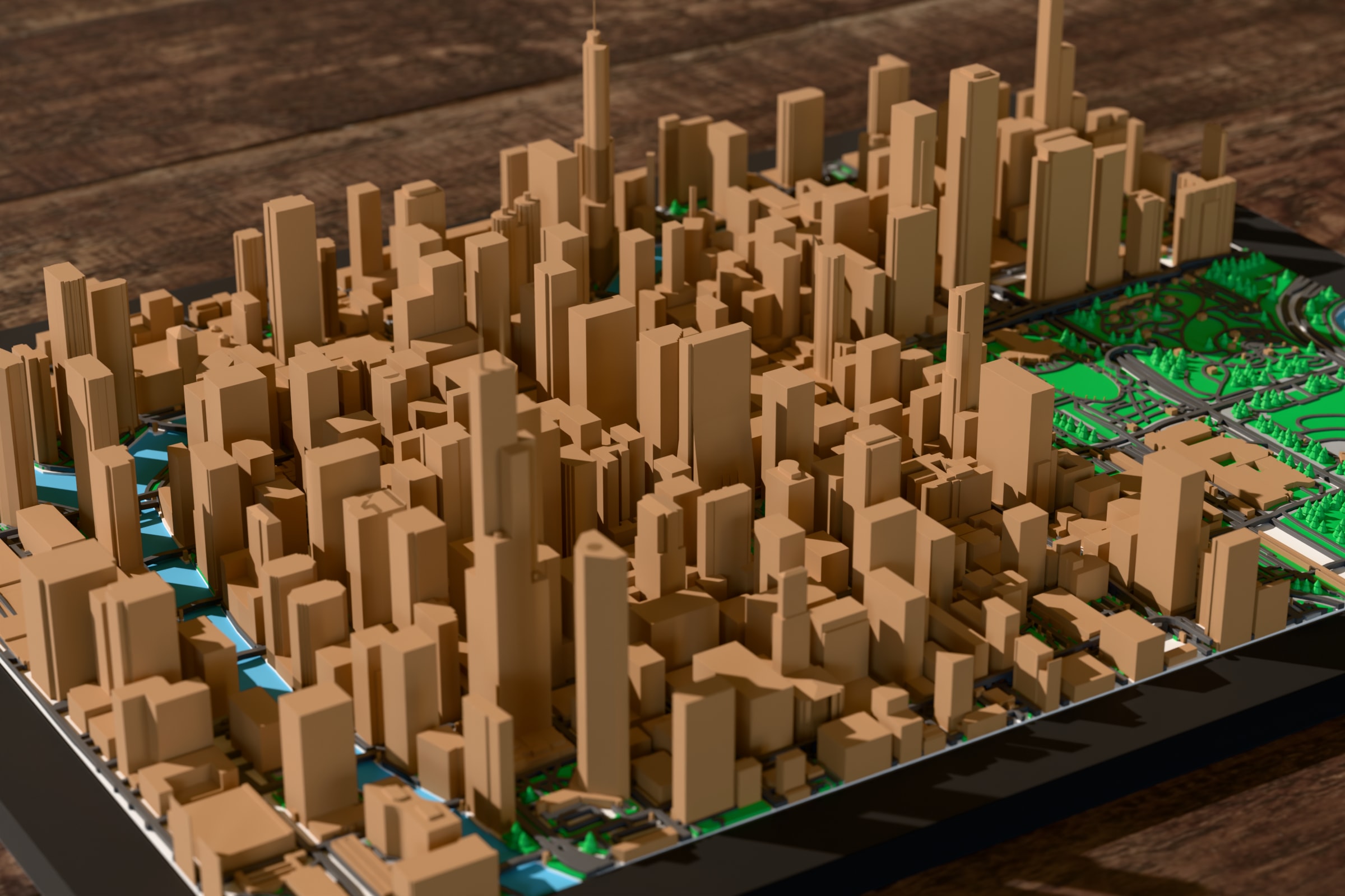
3D preview: Chicago, map data. Buildings from map data, which gives each one an outline and a height.

Chicago, map data

Buildings from map data, which gives each one an outline and a height.

Download JPEG, 2400 × 1600, 410 KB

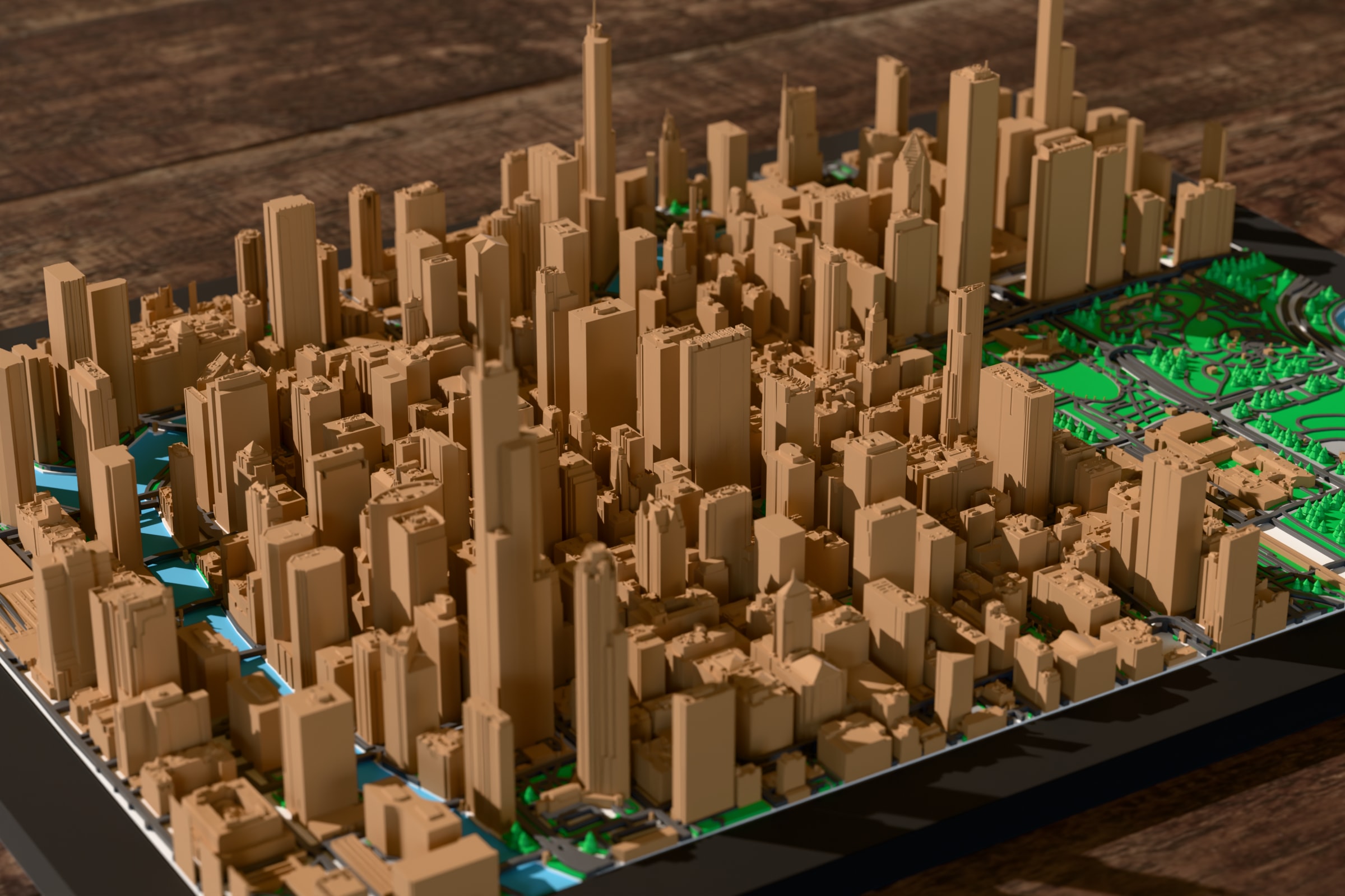
3D preview: Chicago, LiDAR buildings. The same area, with the buildings measured from a LiDAR survey.

Chicago, LiDAR buildings

The same area, with the buildings measured from a LiDAR survey.

Download JPEG, 2400 × 1600, 465 KB

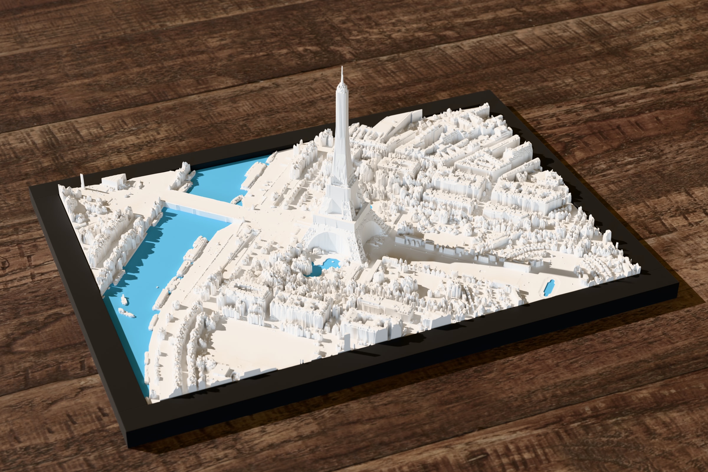
3D preview: Paris, LiDAR only. Around the Eiffel Tower, built from the scan alone.

Paris, LiDAR only

Around the Eiffel Tower, built from the scan alone.

Download JPEG, 2400 × 1600, 589 KB

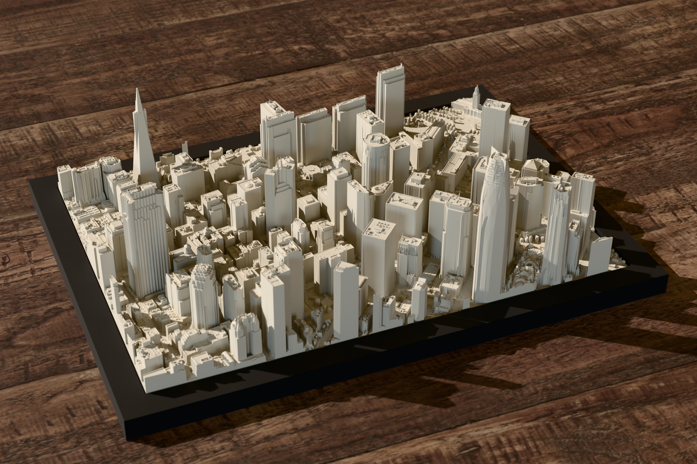
3D preview: San Francisco, LiDAR only. Downtown, built from the scan alone.

San Francisco, LiDAR only

Downtown, built from the scan alone.

Download JPEG, 2400 × 1600, 566 KB

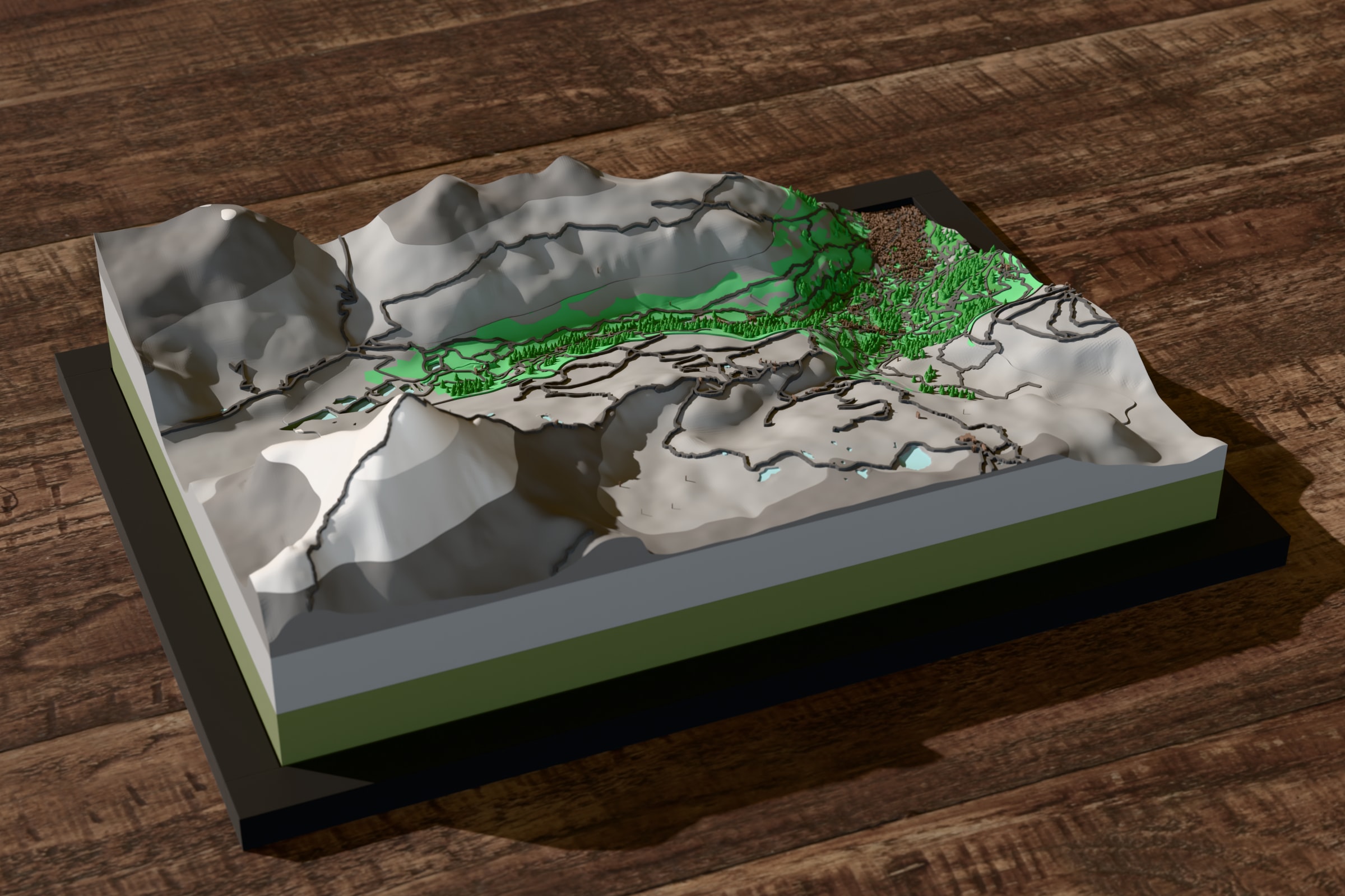
3D preview: Matterhorn. Terrain colored by height in the Alpine style.

Matterhorn

Terrain colored by height in the Alpine style.

Download JPEG, 2400 × 1600, 479 KB

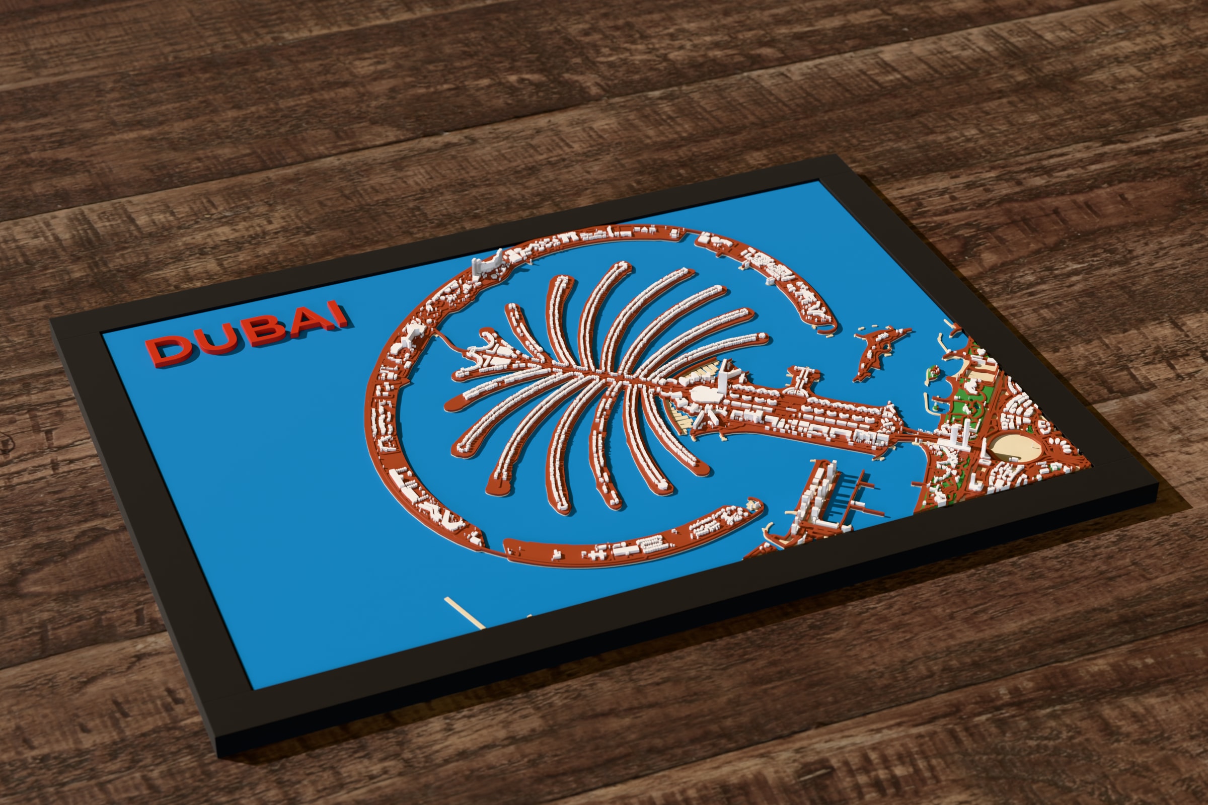
3D preview: Palm Jumeirah, Dubai. With the name printed on the water.

Palm Jumeirah, Dubai

With the name printed on the water.

Download JPEG, 2400 × 1600, 587 KB

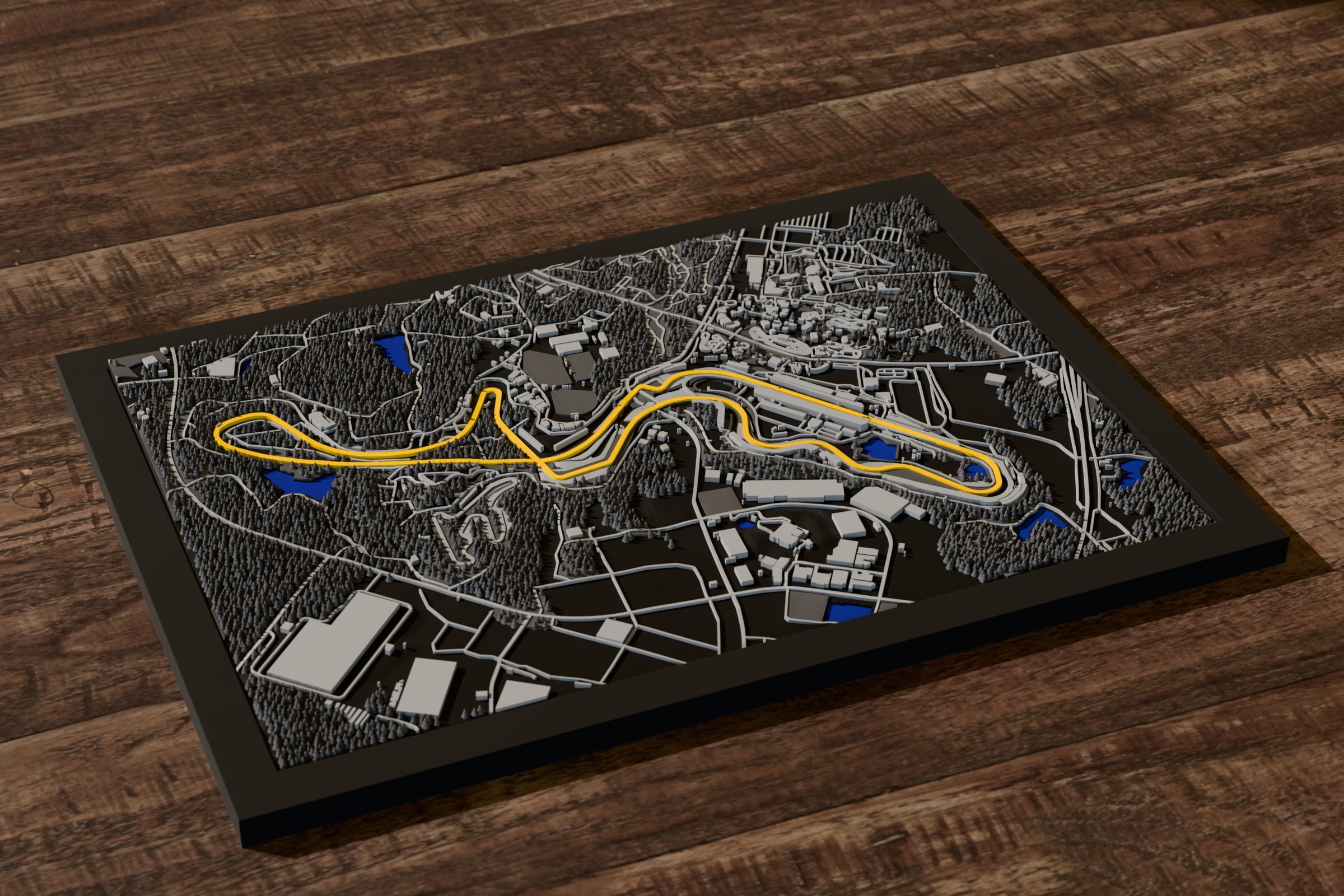
3D preview: Suzuka Circuit. One of the built-in racetracks, with the track in its own color.

Suzuka Circuit

One of the built-in racetracks, with the track in its own color.

Download JPEG, 2400 × 1600, 705 KB

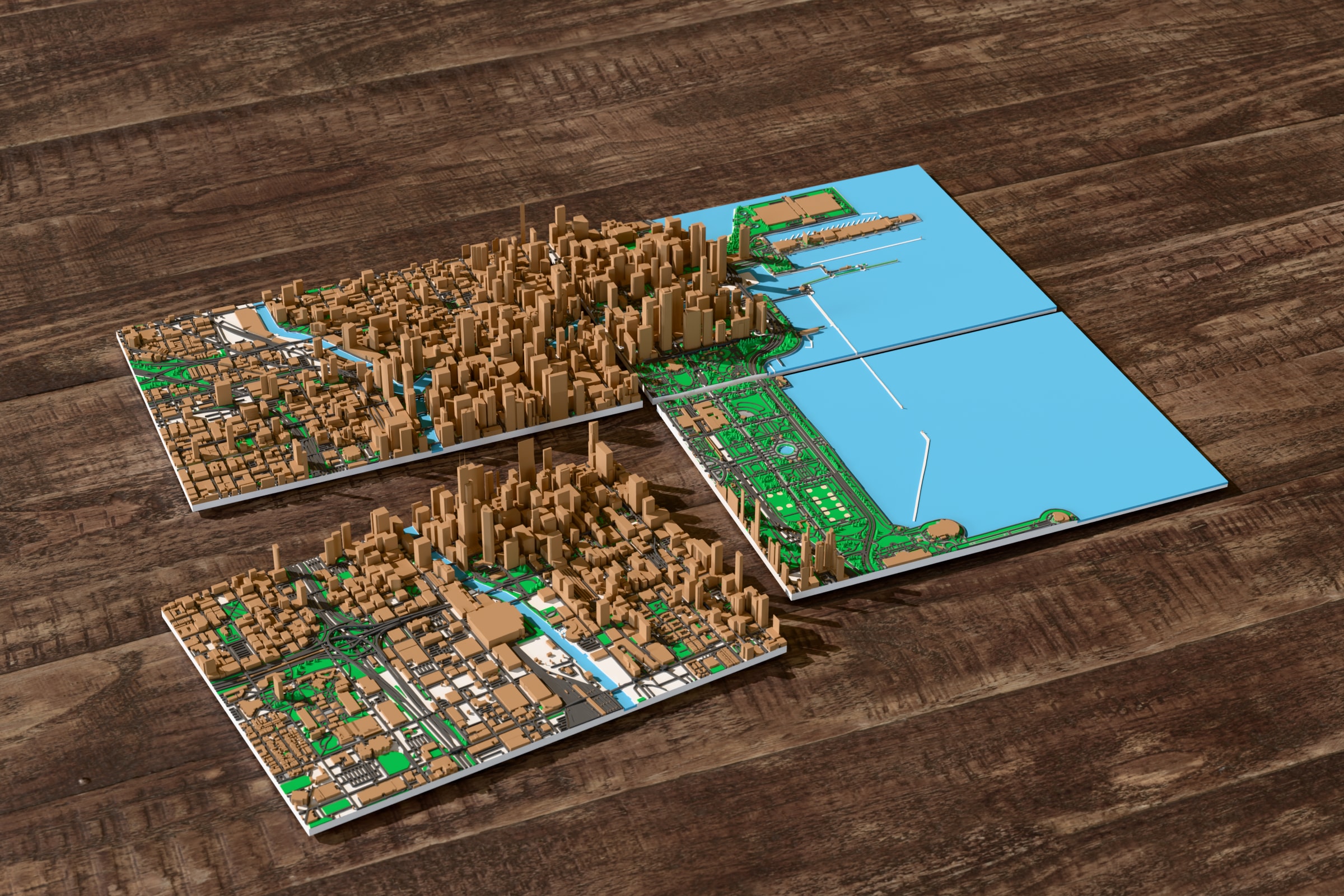
3D preview: Chicago on four plates. A larger area split to fit the printer, plates laid apart.

Chicago on four plates

A larger area split to fit the printer, plates laid apart.

Download JPEG, 2400 × 1600, 889 KB

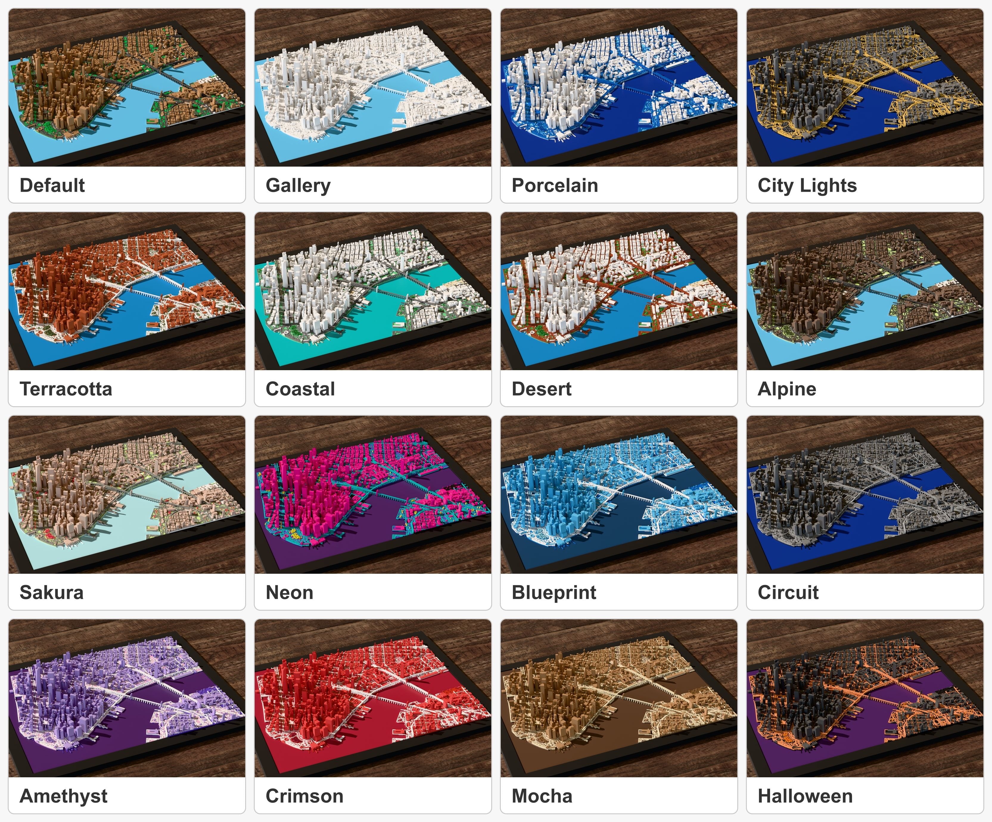
3D preview: Color themes. One model in each of the built-in color themes.

Color themes

One model in each of the built-in color themes.

Download JPEG, 3330 × 2758, 1.8 MB

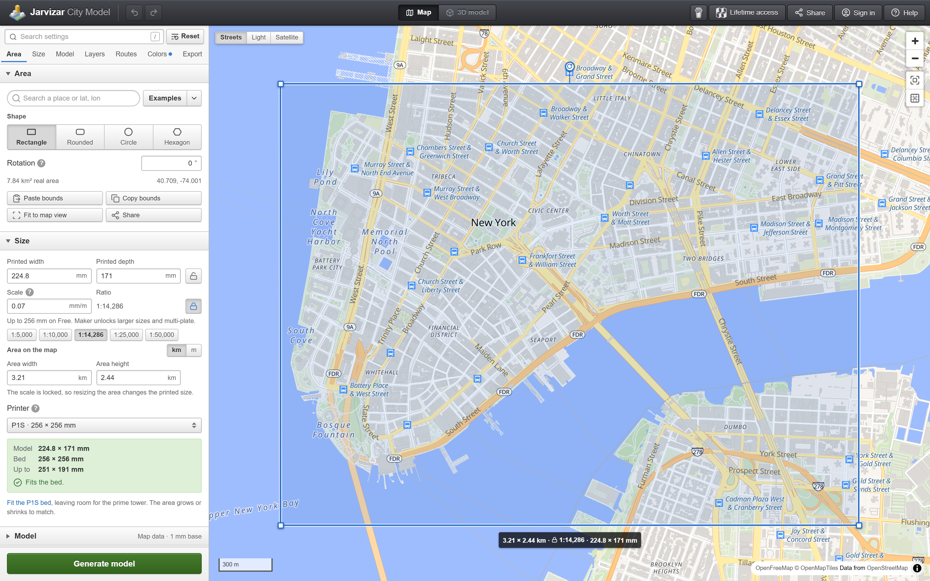
The app in a desktop browser, at twice the screen resolution.

Screenshot: Picking the area. Lower Manhattan picked on the map, with the size and printer settings.

Picking the area

Lower Manhattan picked on the map, with the size and printer settings.

Download JPEG, 3200 × 2000, 1.4 MB

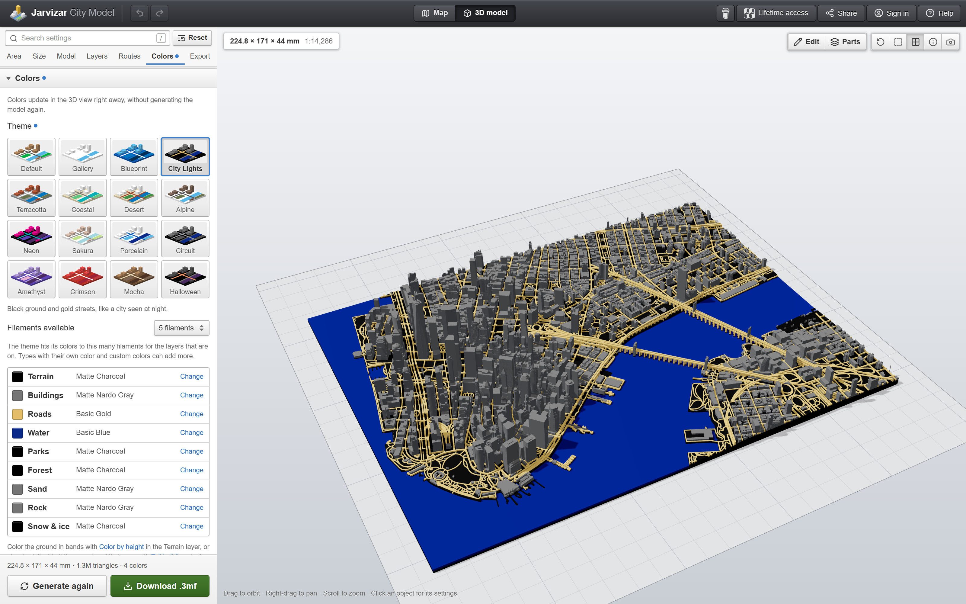
Screenshot: Colors. The 3D view, with the City Lights theme and the filament for each part.

Colors

The 3D view, with the City Lights theme and the filament for each part.

Download JPEG, 3200 × 2000, 903 KB

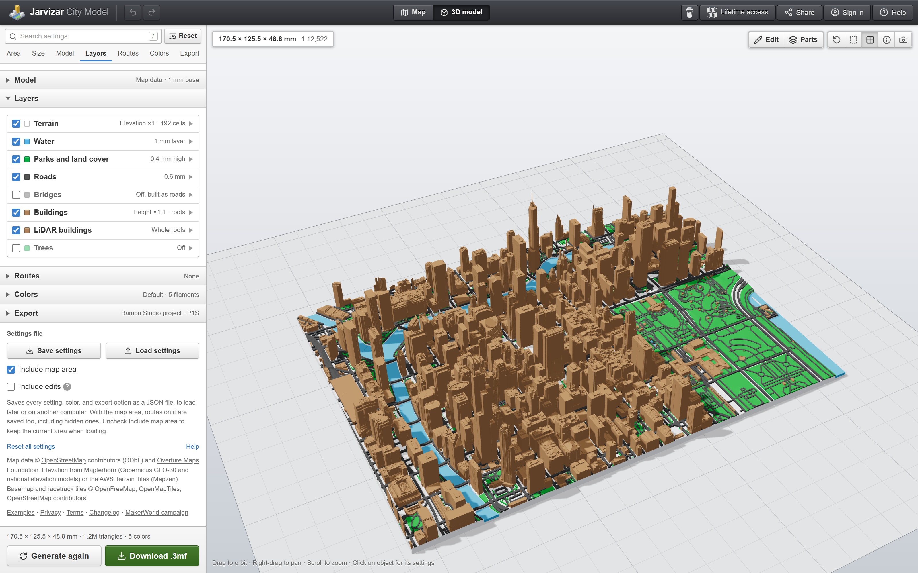
Screenshot: LiDAR buildings. Chicago with buildings measured from LiDAR, and the model's layers.

LiDAR buildings

Chicago with buildings measured from LiDAR, and the model's layers.

Download JPEG, 3200 × 2000, 906 KB

Video

Both may be cut into other videos.

Campaign video

Real prints and 3D previews, each labeled, of what the app makes. No sound.

Download MP4, 1080 × 1080, 60 seconds, 11.3 MB

Making a model

Searching for Chicago, moving the area, generating, and the 3D view, at real speed. No sound.

Download MP4, 1440 × 1080, 11 seconds, 2.5 MB

Pricing and Campaign

The app is free, including downloads up to 256 mm across, and that isn't changing. Paid tiers add tools and are sold as lifetime access through a crowdfunding campaign on MakerWorld, Bambu Lab's site for 3D models. Every paid tool can be tried in the free app. Only the download needs the tier.

TierAddsPrice
Free The map generator, every color option, LiDAR buildings in the free LiDAR areas, the sample routes and racetracks, and basic editing. Downloads up to 256 mm across. Free
Maker Custom routes, names and map pins, drawn roads and buildings, and prints split across plates. $25$19 for the first 50
Pro Everything in Maker, plus LiDAR buildings anywhere there is public survey data, and LiDAR only models. $79$59 for the first 50
Commercial Everything in Pro, plus a license to sell prints. $199$149 for the first 50

Prices in US dollars. Every backer tier also gets a pack of 13 ready-to-print models and every stretch goal that's reached.

Opens
November 10, 2026, 10 am Eastern
Ends
December 10, 2026
Goal
$1,000
Stretch goals
$2,500: Smart seams and plate connectors
$5,000: Advanced edit mode
$10,000: State and country models
Codes
Sent to backers by December 17, 2026
Late pledges
Open for about 30 days after the end, still with lifetime access
After that
The paid tools move to a subscription for new users. Backers keep their tier.
Embargo
None. The app is live, and the campaign page can be followed before it opens.

The campaign on MakerWorld

Background

Photo: miniatures Adam made by hand in Blender before the app

Before the app

Some of Adam's earlier miniatures, made by hand in Blender. Not made with the app.

Download JPEG, 3000 × 2250, 1.3 MB

From the campaign page, in Adam's words:

I've been making miniature cities & racetracks for MakerWorld for a couple of years now. By now I've created over 150 of them, all by hand in Blender using the Blosm add-on. Over time, those models have been downloaded more than 130,000 times, and nearly 28,000 people have followed along on MakerWorld!

Every one started as a very basic model that required a lot of cleanup before it would actually print. Zero-height roads disappearing in the slicer, non-manifold edges, splitting everything into separate parts so it could be printed in multi-color, spending hours manually fixing incorrect heights and adding back missing buildings, etc.

Over time, I also started getting more and more requests for places I hadn't made, many of which I'd never even considered myself. The existing online tools were great starting points, but I kept wishing there was an easier way for anyone to go from map data to a finished, printable model.

That's what led me to start building City Model. Making all those miniatures by hand taught me a lot about what makes a map model look good and print well, and I wanted to put that experience into a tool that anyone could use to make their own.

I'm a software engineer by day, so building the web app itself was the more familiar part. LiDAR was by far the biggest challenge. Every country, and sometimes even individual states or cities, publishes its scans differently. Getting all those different sources working together, and keeping them working, has taken a lot of time.

Contact

Adam Jarvis, citymodel@jarvisar.com, for questions, interviews, or a code to review the paid tiers.

Last updated November 4, 2026.